As part of its Smart City project, the Department of European Projects and Strategic Objectives of the Cieza City Council is providing citizens with a space to search and view georeferenced data for the municipality of Cieza. This tool will be the primary channel for disseminating spatial data of interest to the public. This project was made possible thanks to funding from the 80% (Educational Development Strategy for Sustainable and Integrated Urban Development) from the EDUSI (Educational Development Strategy for Sustainable and Integrated Urban Development).
Furthermore, this Geoportal represents an essential tool for the various departments of the city council, improving decision-making efficiency and optimizing the management of municipal resources and services. Updated geospatial data enables better project planning and execution, as well as more effective land management.
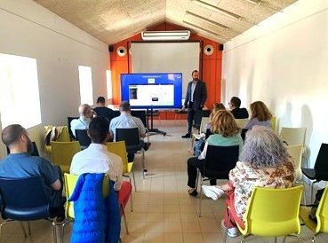
To ensure optimal use of this new tool, the Cieza City Council launched training sessions for its employees. The objective of these training sessions was to train municipal employees in the use and applications of the Geoportal, thus ensuring they can effectively utilize this technology in their daily work.
The Geoportal can be accessed through the Cieza City Council website, and will provide access to important viewers such as street maps, tourism and sports routes, and solar energy potential.