


Tomorrow the Storm Bruno It will be located south of Ireland and will begin to affect us. Windy weather is expected in large areas of the Iberian Peninsula and the Balearic Islands, as well as rough seas along many of our coasts and heavy rainfall in areas of Galicia and the Cantabrian Sea.
Region of Murcia
This Wednesday, the first half of the day will be dominated by winds from the WNW, which will blow with very strong gusts, especially in inland areas of the Region of Murcia.
The State Meteorological Agency has issued an orange and yellow alert for winds of between 70 and 80 kilometers per hour in the Northwest and the Guadalentín Valley, and a yellow alert for the rest of the region, including Vega del Segura, Campo de Cartagena, the Altiplano, and Murcia.
Also tomorrow Wednesday 27th (early morning and morning) significant wave heights of 2.5 to 3.5 m are expected on the coasts of Mazarrón and Cartagena with yellow warning activated.
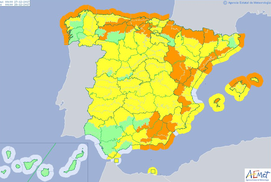
Spain
In the rest of Spain the Storm Bruno will leave snowfall Significant rainfall, especially in the mountainous areas of the north and northwest of the Iberian Peninsula. The situation will begin on the afternoon of Tuesday the 26th with the entry of an active front through Galicia. The rainfall will spread from west to east.
Throughout the afternoon and evening of Tuesday the 26th and the early hours of Wednesday the 27th, they will affect virtually all areas, with a low probability in the extreme southeast. On Wednesday afternoon, they will likely be restricted to the northern area.
Precipitation will be persistent and locally heavy, with possible thunderstorms and hail, in areas of Galicia and the Cantabrian Sea. Daytime temperatures will drop across the region.
The quota of snow Snowfall could drop to 700/1000 m in the north, 1000/1200 m in the centre and 1200/1500 m in the southeastern mountains on Wednesday. Snow accumulations of 20-30 cm are likely in the Pyrenees and Cantabrian Mountains, 5-10 cm in the Central and Iberian systems and SE mountain ranges.
He wind It will be a widespread adverse factor. It will begin to intensify in the northwestern part of the peninsula on Tuesday afternoon, spreading to much of the peninsula during the early hours of Wednesday, while it begins to subside in the northwest.
He Thursday the entry of a new one is expected Atlantic front, but the weather situation will not have the adverse characteristics of the previous days, although it is likely that the snowfall significant in the environment of Pyrenees.
Westerly winds are expected to reach very strong gusts across much of the Iberian Peninsula and the Balearic Islands, possibly exceeding 100-110 km/h in areas of the northwest and north of the Iberian Peninsula, and 70-80 km/h in the remaining areas and the Balearic Islands.